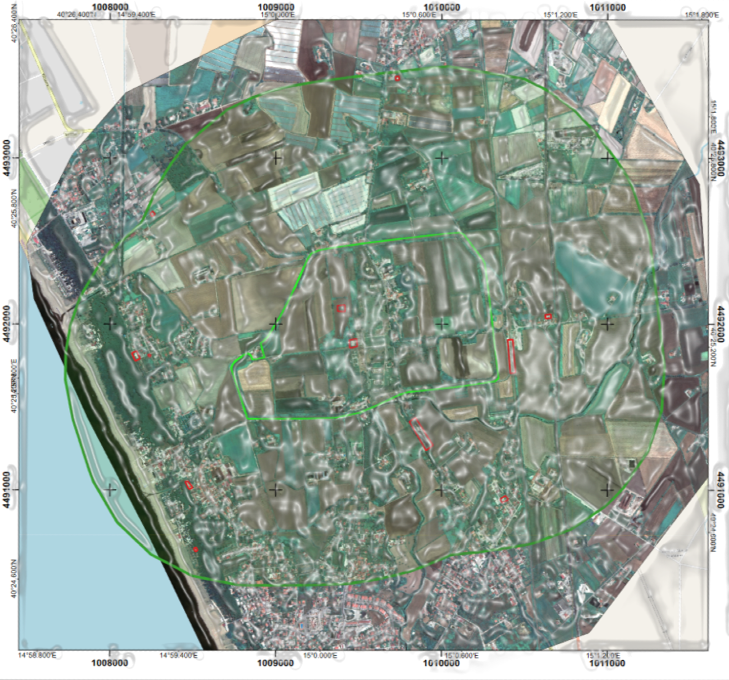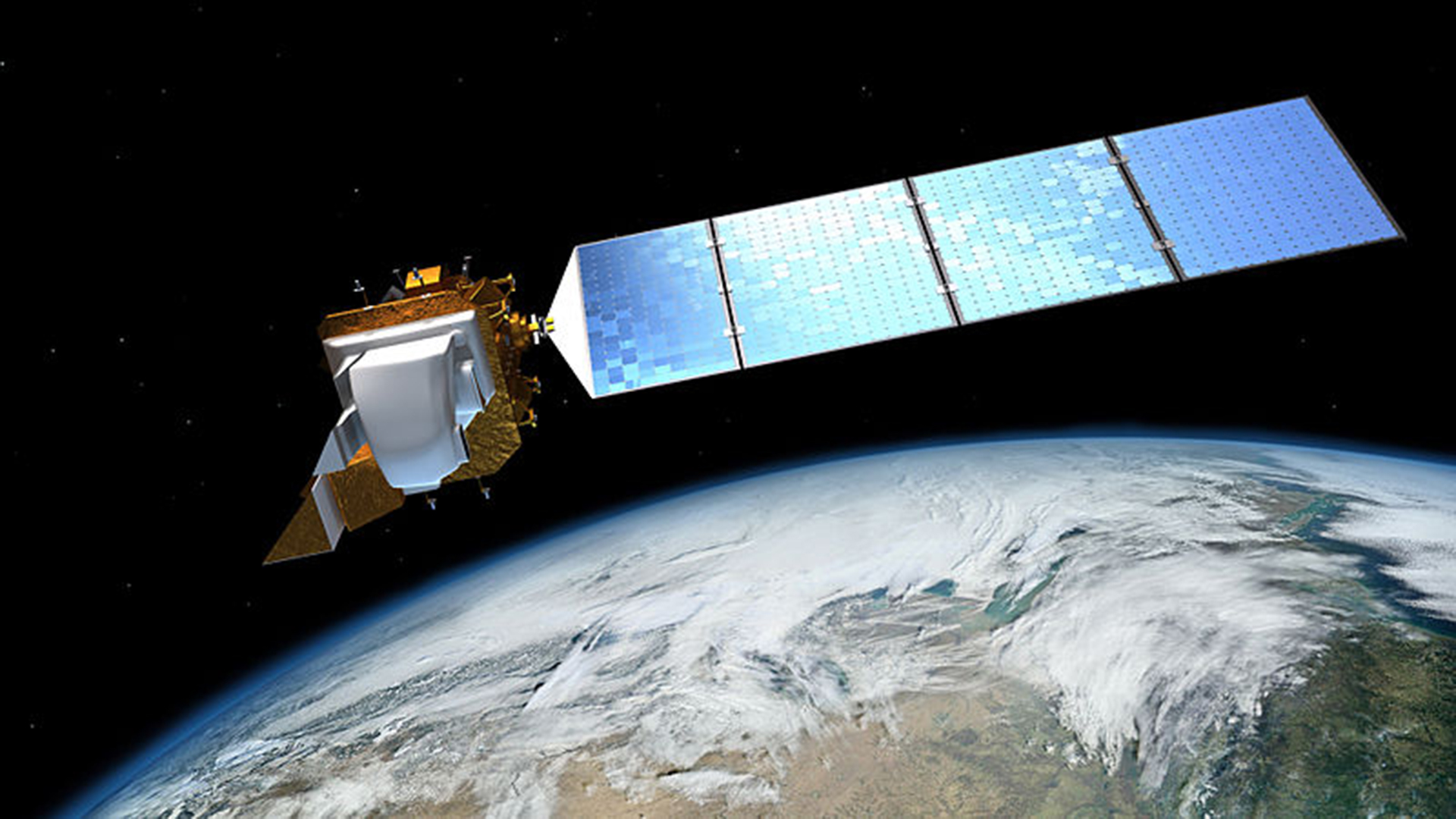
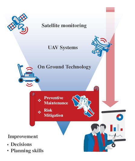
SATELLITES
Used for the large-scale identification of criticalities, both natural and anthropogenic, involving cultural heritage and their surroundings

DRONES
Equipped with multispectral, thermal and radar optical sensors. They are used for detailed analysis of soil and masonry structures
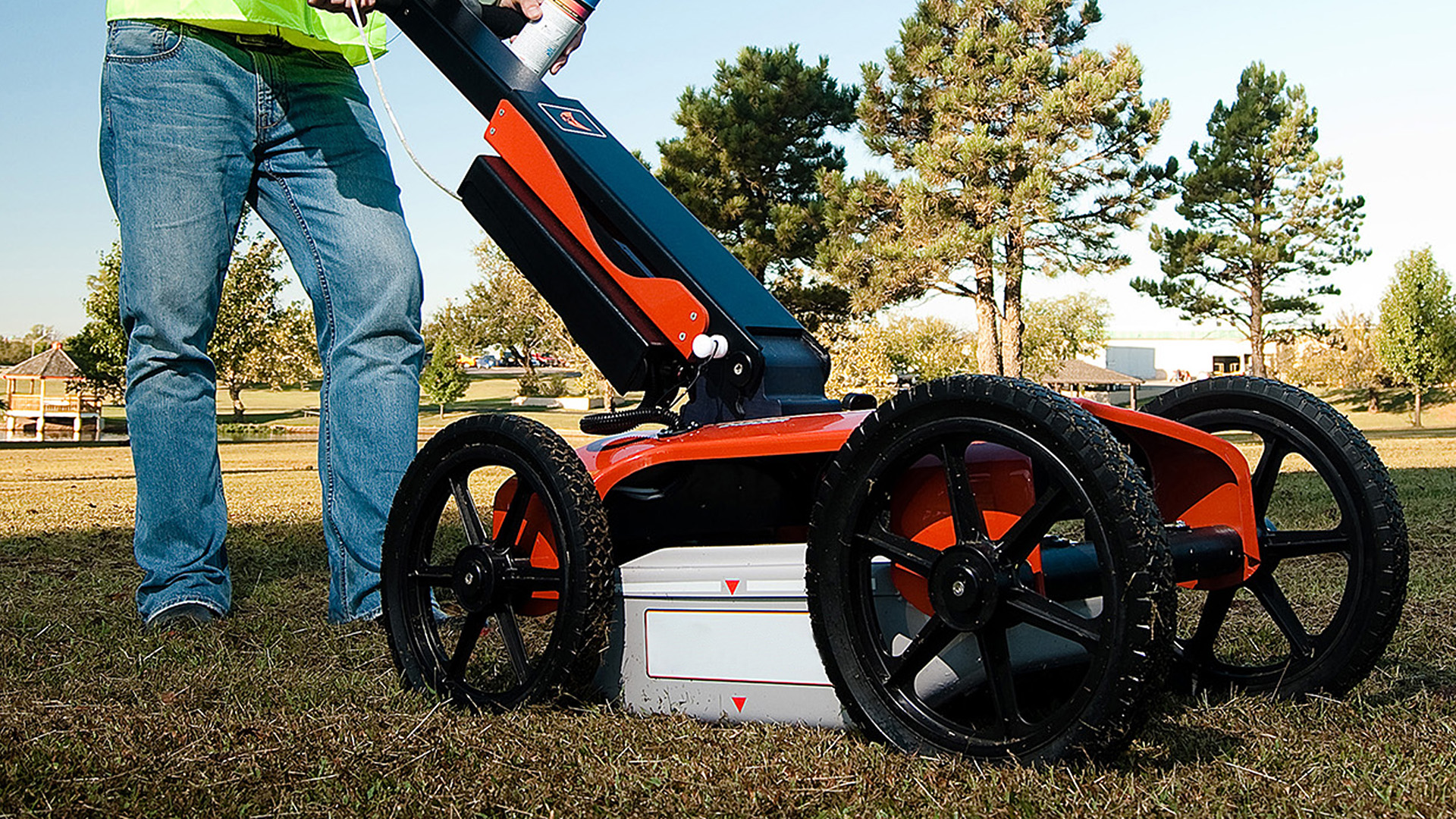
GPR
High and low frequency are used for inspections, respectively, of the wall structures and the subsoil
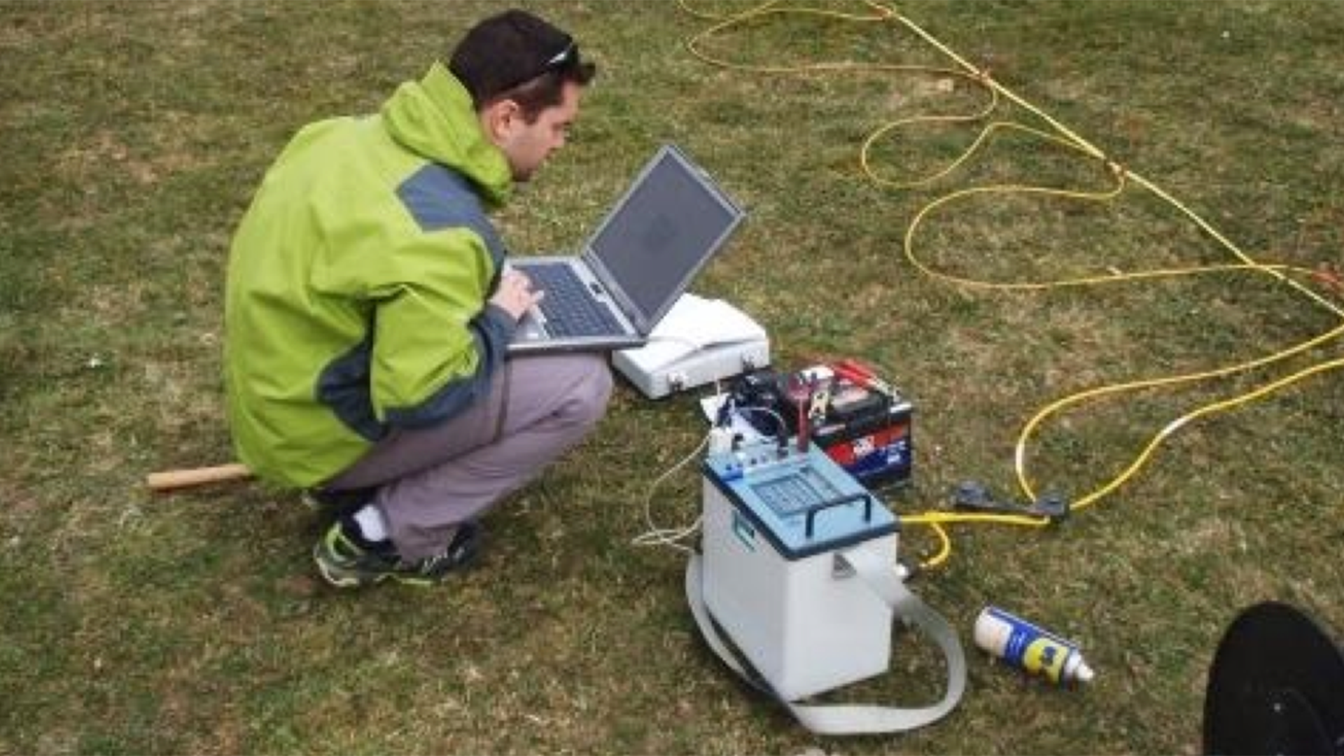
ERT
Electrical Resistivity Tomography
Used for investigation of the subsoil
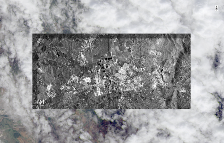
Immagine che mostra la capacità del sensore SAR (rettangolo centrale) di acquisire informazioni anche in caso di copertura nuvolosa.
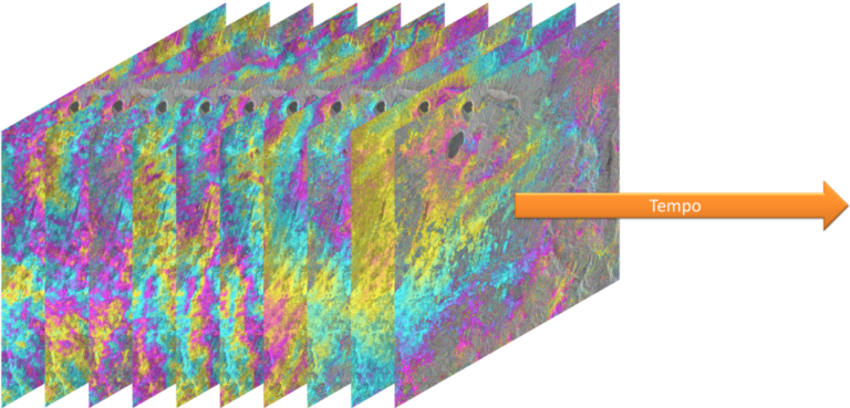
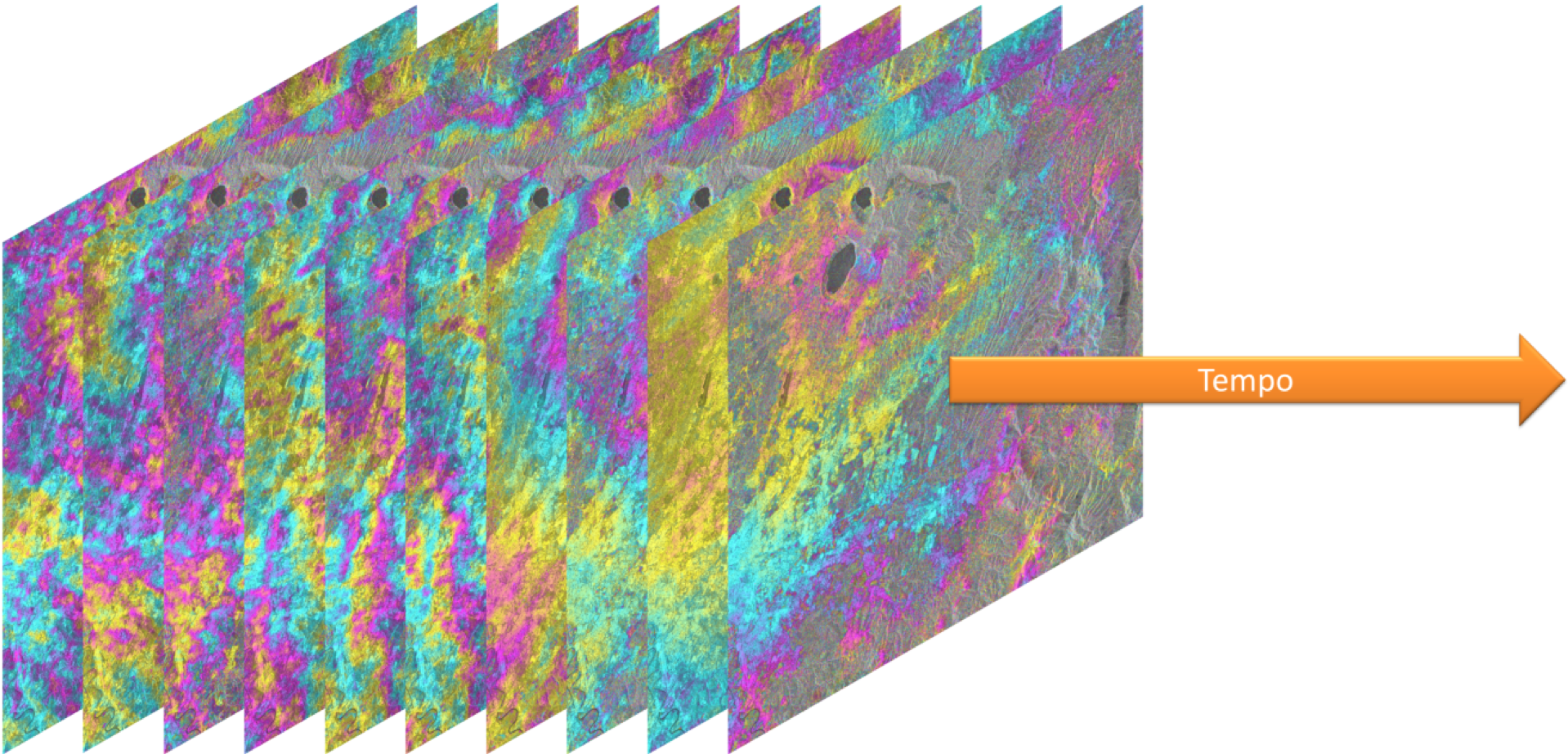
Esempio di collezione di interferogrammi necessaria per analisi interferometriche (sia PS che SBAS). Il numero minimo di immagini per ciascuna analisi è di 50 acquisizioni per scena elaborata.
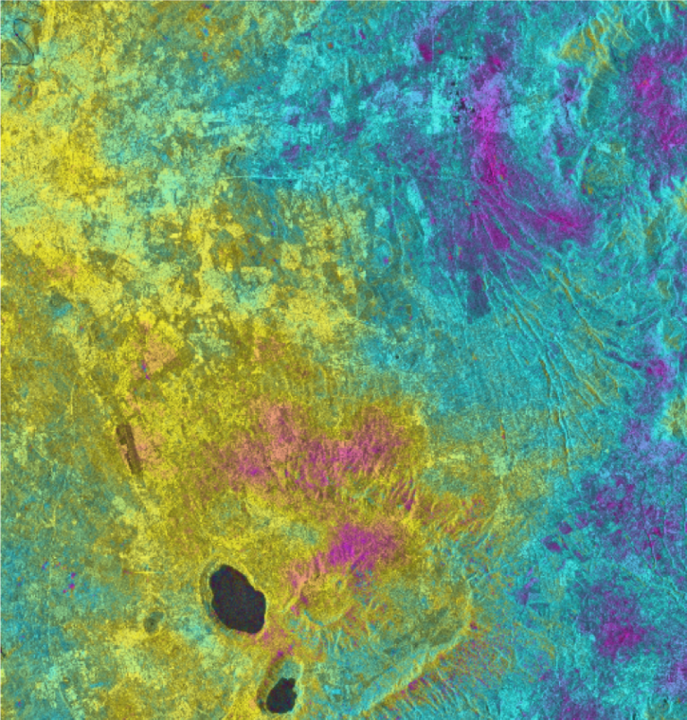
Interferogramma (differenza di fase) ottenuto da una coppia di immagini di Sentinel-1
Rappresentazione in falsi colori dell’indice di NDVI
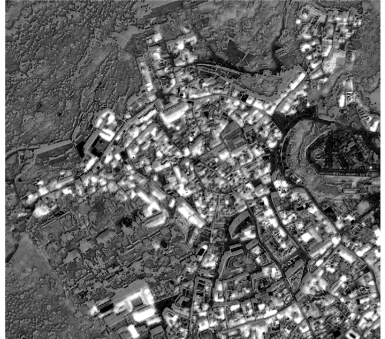
Elaborazione in scala di grigi delle statistiche di appartenenza ad una classe (in questo caso, tetti in laterizio). Informazione utilizzata sia a scopi di verifica che di post-processing.
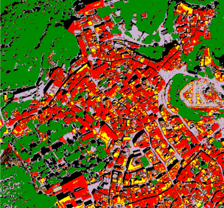
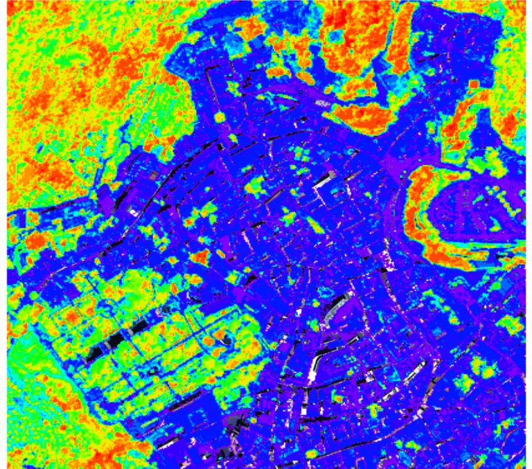
Mappa di classificazione generata tramite algoritmi di classificazione supervisionata SVM (Support Vector Machine)
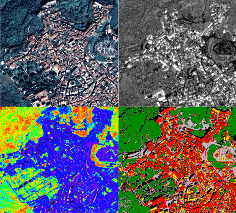
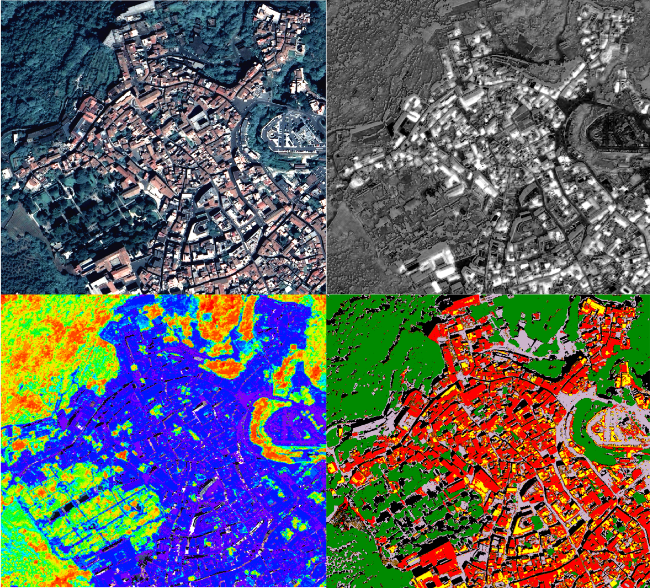
Immagine composita. Dall’angolo in alto a sinistra, in senso orario: immagine satellitare ad altissima risoluzione WorldView-3; mappa delle statistiche ottenute dal processo di classificazione; mappa di classificazione ottenuta con tecnica SVM; indice NDVI.