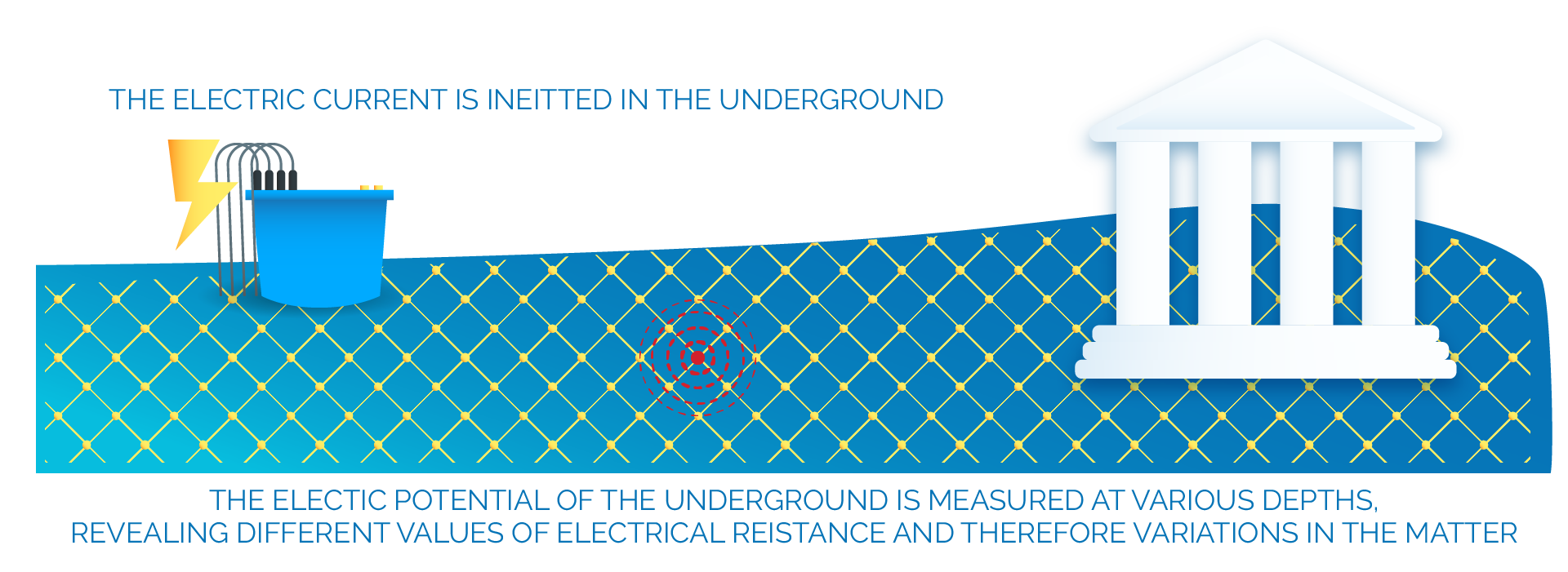
Electrical Resistivity Tomography (ERT) is a geophysical technique that allows to estimate the different resistivity values of the materials present in the subsoil.
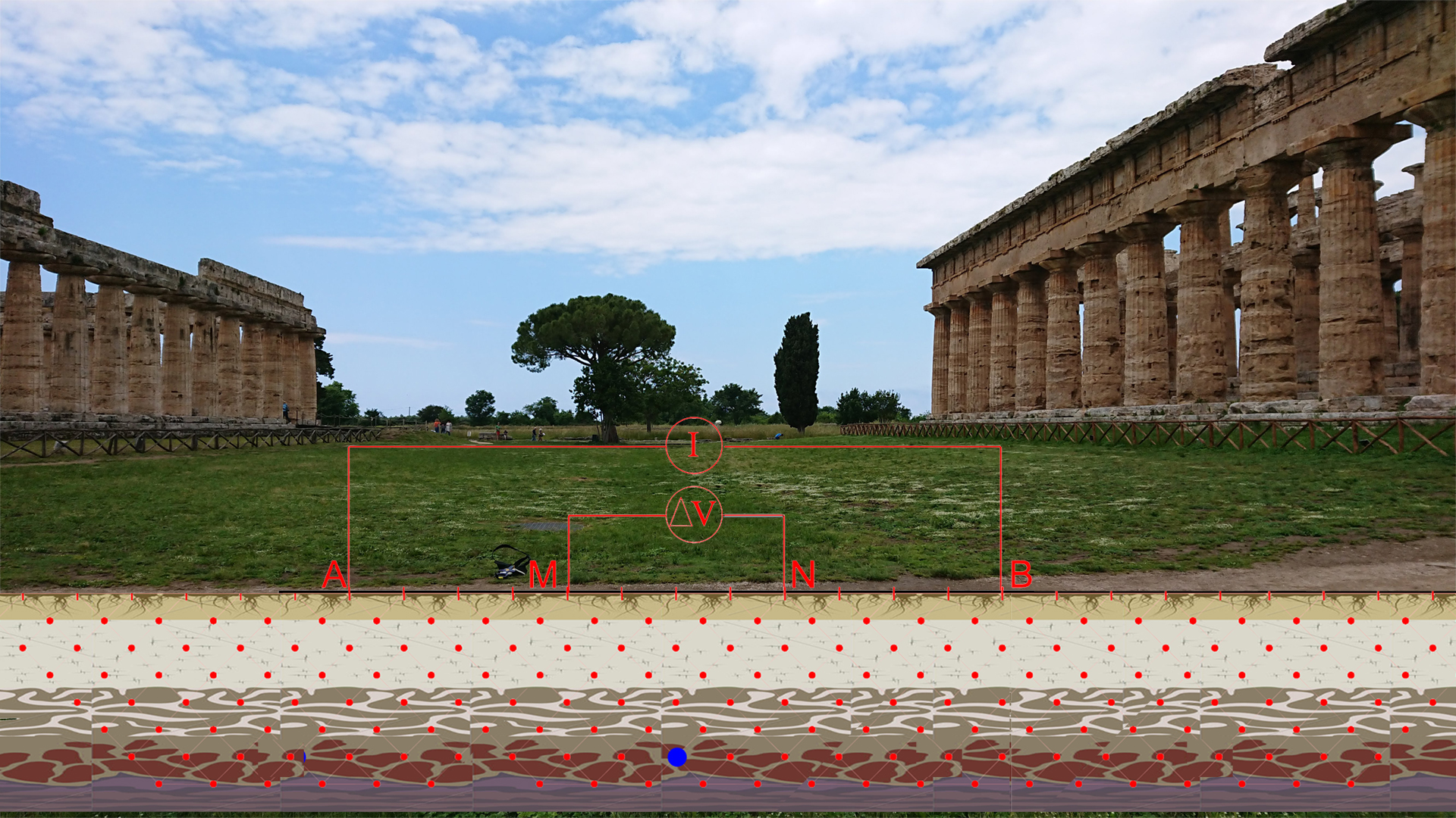
It is based on the injection of electric current into the subsoil with a pair of electrodes and the subsequent measurement of the electric potential using another pair of electrodes.
it allows to investigate areas at greater depth compared to GPR .
The result of an ERT acquisition is an image that represents the distribution of resistivity values at different depths of the subsoil in false colors.
The different resistivity reveals differences in the underground stratigraphy allowing to investigate the subsoil in a non-destructive way.
How does it work?
INVESTIGATIONS
Four geoelectric surveys were carried out as part of the VESTA project: in the area behind the ancient baths; in the residential areas developing west of the monumental Temples of Neptune and Hera; between the Temples of Neptune and Hera.
The investigations aimed to analyze the variability of the electrical conductivity (or resistivity) of the subsoil with different levels of depth of investigation.
Electrodes A and B were positioned in the investigated areas from which the electric current is sent. The current generates an electrical voltage which is sensed by two other electrodes, M and N.
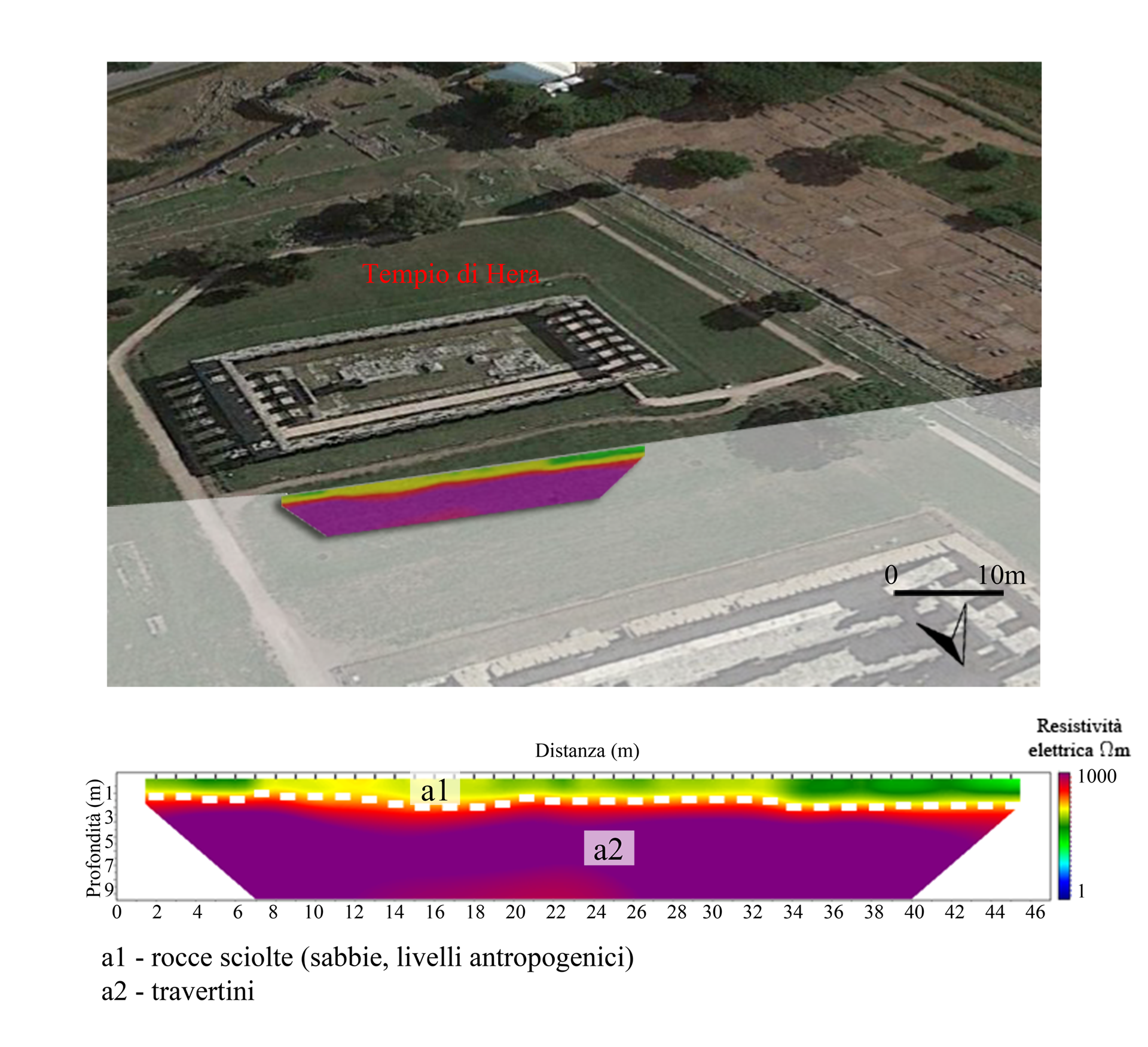
RESULTS
The survey data are processed to obtain a map of the soil resistivity which is interpreted by the experts.
It is possible to analyze the stratigraphy of the subsoil by identifying the various geological or man-made formations this way.
The image shows the map of the area between the Temple of Neptune and the Temple of Hera.
How do we read a resistivity map?
Let’s look at the results of the investigations carried out in the area of the baths and imagine exploring the subsoil at various depth levels (indicated on the left of the legend).
The areas with greater resistivity have colors tending to fuchsia and indicate the presence of travertine, a sedimentary rock.
The areas with a color tending to blue have a lower resistivity and instead indicate the presence of alluvial deposits.
Questo sito usa i cookie per migliorare la tua esperienza. Continuando la navigazione, acconsentite all'utilizzo, altrimenti clicca per maggiori informazioni. Info & ImpostazioniAccetto
Privacy & Cookies Policy
Privacy Overview
This website uses cookies to improve your experience while you navigate through the website. Out of these cookies, the cookies that are categorized as necessary are stored on your browser as they are essential for the working of basic functionalities of the website. We also use third-party cookies that help us analyze and understand how you use this website. These cookies will be stored in your browser only with your consent. You also have the option to opt-out of these cookies. But opting out of some of these cookies may have an effect on your browsing experience.
Necessary cookies are absolutely essential for the website to function properly. This category only includes cookies that ensures basic functionalities and security features of the website. These cookies do not store any personal information.
Any cookies that may not be particularly necessary for the website to function and is used specifically to collect user personal data via analytics, ads, other embedded contents are termed as non-necessary cookies. It is mandatory to procure user consent prior to running these cookies on your website.